Conservation & Communities – Trends in Geospatial Technology
GIS by Academic Division
Mapping TV: 50 Maps of the U.S. Cultural Divide
New York Times maps of the popularity of certain TV shows in the US.
Fall 2018 GIS Assistants announced
The Wesleyan GIS Assistant Program pairs a GIS-savvy undergraduate student with a Wesleyan faculty member to assist with GIS-related aspects of a course or a research project. This semester’s assistants include: Azher Jaweed ’19 History & Environmental Studies Jenny Aguilar ’19 Sociology with Data Analysis minor … Read more
Earth’s curvature and US road corrections
Two interesting articles about longitude and the US road/landholdings grid. The artist’s website: http://www.gercoderuijter.com/gerco2/.
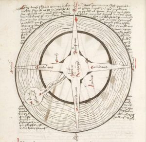
Apocalyptic Cartography: Thematic Maps and the End of the World in a Fifteenth-Century Manuscript
WesMaSS GIS
The Wesleyan Mathematics and Science Scholars Program is a two-year program that begins the summer immediately prior to a student’s first year at Wesleyan. The summer program consists of several pre-matriculation activities to prepare students for the academic expectations in Wesleyan math and physical science courses. This summer’s WesMaSS cohort learned the basics of GIS … Read more
WesGIS Workshop: Integrating surveys and mobile mapping with Survey123
WesGIS Workshop: Integrating surveys and mobile mapping with Survey123 Friday April 21, 2017 1:30-2:30 pm PAC 100 Combine the power of smart forms and geography! Survey123 is a simple and intuitive form-centric data gathering solution for creating, sharing, and analyzing survey data. Location data can be easily integrated into the survey creation and analysis. Capture … Read more
Wesleyan GIS students in the news
Introductory GIS students presented their community-based service-learning projects in early December. Read about their projects at the Hartford Courant, Wesleyan’s Engage blog, and Wesleyan News.
Enlightening election map
One of the more interesting set of maps for the US 2016 Presidential Election. The maps show some of the nuances of the geography of the results.
WesGIS Hands-On Workshop: Make Your Own Presidential Election Map
Intrigued by the red/blue US maps prevalent in the news media this time of year?  Transfixed by the real-time, digital maps of the evolving results on election night? Or merely want to learn how to make a basic map in GIS? Learn how to use a Geographic Information System to map and visualize 2016 election results. This hands-on workshop for Wesleyan faculty and staff is open to both beginner and intermediate users of GIS. No registration required.
Friday, November 11, 2016
11:00 am – noon
PAC 100


