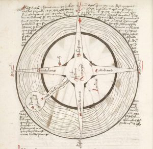
a lecture by Chet Van Duzer
2-4 pm, Saturday, October 7
Fisk 208
Arts and Humanities
WesGIS Workshop: Integrating surveys and mobile mapping with Survey123
WesGIS Workshop: Integrating surveys and mobile mapping with Survey123 Friday April 21, 2017 1:30-2:30 pm PAC 100 Combine the power of smart forms and geography! Survey123 is a simple and intuitive form-centric data gathering solution for creating, sharing, and analyzing survey data. Location data can be easily integrated into the survey creation and analysis. Capture … Read more
Wesleyan GIS students in the news
Introductory GIS students presented their community-based service-learning projects in early December. Read about their projects at the Hartford Courant, Wesleyan’s Engage blog, and Wesleyan News.
Enlightening election map
One of the more interesting set of maps for the US 2016 Presidential Election. The maps show some of the nuances of the geography of the results.
WesGIS Hands-On Workshop: Make Your Own Presidential Election Map
Intrigued by the red/blue US maps prevalent in the news media this time of year?  Transfixed by the real-time, digital maps of the evolving results on election night? Or merely want to learn how to make a basic map in GIS? Learn how to use a Geographic Information System to map and visualize 2016 election results. This hands-on workshop for Wesleyan faculty and staff is open to both beginner and intermediate users of GIS. No registration required.
Friday, November 11, 2016
11:00 am – noon
PAC 100
Students present posters, win prizes at GIS conference
Eight E&ES 344 Advanced GIS students presented posters at the Northeast Arc Users Group Spring Spatial Technologies Conference, May 9, University of Massachusetts Amherst. The posters highlighted the students’ semester-long research and service-learning projects incorporating applications of advanced geographic information systems skills. Titles and abstracts for the posters can be found at http://nearc.sites.amherst.edu/program2016/. Stephanie Ling (’16) won the poster contest with her innovative spatial humanities research with Prof Gary Shaw examining the spatiotemporal mobility of bishops in Medieval England. E&ES 344, taught by Kim Diver, is a project-based learning course that is part of the Academy for Project-Based Teaching and Learning hosted by the Center for Pedagogical Innovation. The 14 students in the course conducted independent research projects, worked with faculty on their research projects, or collaborated with community partners on service-learning projects. Half of the course’s projects were represented at the conference.
Space, Place, and Geographic Thinking in the Humanities
2016 CGA Conference: Space, Place, and Geographic Thinking in the Humanities
Center for Geographic Analysis (CGA), Harvard University, April 28-29, 2016
GIS Working Group Meeting, April 27
Do you plan to integrate geographic information system (GIS), mapping, or other spatial analyses into an upcoming course or project? Perhaps a GIS Assistant can help.
GIS Working Group Meeting
GIS Assistants: What can they do for you?
Wednesday, April 27, 2:40 pm
Usdan 110
During the meeting, current and former faculty participants in the GIS Assistant Program will discuss their experiences with including a GIS Assistant in their teaching or research. The meeting is open to all faculty and staff.
Free geospatial MOOC – Skills for the Digital Earth
Skills for the Digital Earth MOOC – through Elmhurst College – 3 through 30 April 2016: http://www.elmhurst.edu/admission/school_for_professional_studies/239271581.html Ever stop to think about how important location is when using your smart phone? This educational MOOC begins with an explanation of how society uses location in a myriad of disciplines. Geography, or rather, “where?” is important to … Read more
The Stonehenge World Heritage Site Landscape story map
Go to http://services.historicengland.org.uk/rrstonehenge/ for an interactive, virtual Stonehenge experience.

