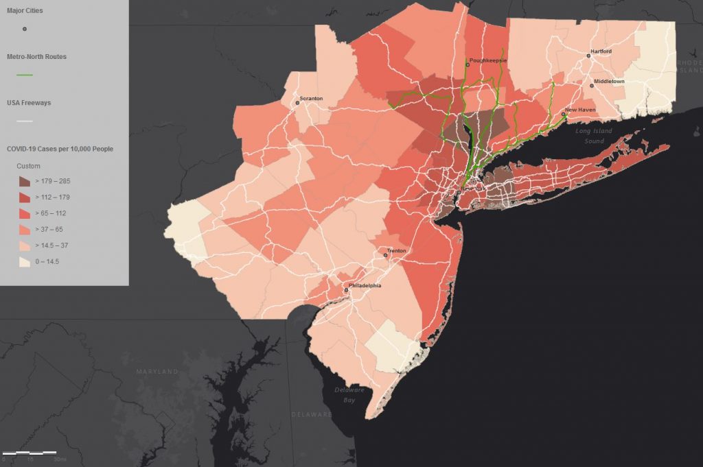
A former and a current GIS Assistant (Grant van Inwegen and Jesse Simmons) used ArcGIS Online to help create a regional view of the NYC COVID-19 outbreak. Here is an excerpt from the Traveler’s Lab blog post at https://travelerslab.research.wesleyan.edu/2020/04/27/covid-19-in-nyc/. The Traveler’s Lab at Wesleyan University studies the movement of people and objects during the middle ages. Our focus on travel brings overlooked and unrecognized realities to standard historical narratives. In mid-March, as Wesleyan’s campus shut down in response to the COVID-19 pandemic, the Theophanes Project began applying our movement-focused approach to the present crisis. What follows are some results of our collaborative work. Data collection by Rachel Chung (’20), Ezra Kohn (’20), and Prof. Jesse Torgerson. Mapping by Grant van Inwegen (’20) and Jesse Simmons (’21) with assistance from Prof. Kim Diver.
To access the dynamic map, go to https://arcg.is/0mvWPT. Read the complete Traveler’s Lab post for full description of rationale, methods, and data sources.