
#_LOCATIONMAP
Date/Time
Date(s) - 05/05/2017
1:30 pm - 2:30 pm
Category(ies)
 WesGIS Workshop
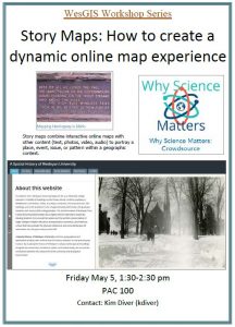
Story Maps: How to create a dynamic online map experience
Friday, May 5, 1:30 pm
PAC 100
Story maps combine interactive online maps with other content (text, photos, video, audio) to portray a place, event, issue, or pattern within a geographic context. Story maps can use the tools of a geographic information system but don’t require creators or users to have any special knowledge of GIS. This workshop for faculty and staff entails hands-on training on how to create a story map. Suitable for beginners or current GIS users that want to update to webmap platforms.